

Menu

Search the PDAS site

Livestock & Landscape West of Wessex continued ....
the best part of two sheep – remains of a feast? Large chunks of fine pot were recovered and other pots from the site have been interpreted as ‘cauldrons’.
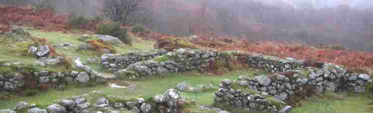
Geophysics can reveal tracks, field patterns, pits and settlement, indications of a farming landscape. The size of fields and arrangements are important and evidence of tracks and gates can give an idea of what animals and how many are being handled and how many people would be involved.
Much of the Southwest has little bone but plenty of evidence of landscape division. In understanding the interaction of both in one location can we draw conclusions? Bronze Age land division on Sigwells shows large parcels of land on upland, possible stock management of cattle and sheep. There are several cases where the project has identified Bronze Age erosion by hillwash, deforestation and possible ploughing.
Smaller Iron Age fields in valleys and hills make more sense as arable land. Again, this raises more questions. How was stock being managed and how does this relate to settlement? Who farmed what and how? Can we assume that everything occurred outside? What scale of fencing would be needed for control of different animals? Would pigs for instance be housed in pens or contained in working hollows?
With regard to arable agriculture, evidence from charred plants and macrofossils, imply that crops were processed at Homeground. Grain and fewer weeds at Sigwells could point to the crop being cleaned by the time it arrived there.In the past pits have been assumed to contain accumulated rubbish. Patterns discovered by J.D Hill indicate they were more organised, with contents often being deliberately placed, this study has tended to concentrate on sites in Wessex. Sigwells, Middle to Late Iron-
During the period of Clare’s research she had access to the site, material and the people doing the work. A different perspective from the Excavator/Project Director extended the ways of addressing overarching research questions.
What does the combination of animal bone groups and posts with visibility on the skyline mean? Is this evidence of totemic animals and association with the Gods in Roman Britain?
Clare aims to pull together the results of her research so that people can use it. By characterising animal husbandry and the attitudes and relationships with animals over time, comparison can be made with other areas and environments. How similar is the Southwest or parts of the Southwest to Wessex, etc. What additional information can be gained by considering the interplay between animal bone data and the layout of landscapes, and how this can contribute to our understanding of how lives were lived?
I am sure that other members present that evening will agree that Clare gave us an interesting and most enjoyable presentation.
_________________
Winter
Lecture Reports
| January |
| February |
| March |
| April |
| May |
| June |
| July |
| August |
| Septmber |
| October |
| November |
| December |
| Pollen Analysis |
| Archaeology of Gardens |
| Identifying Prehistoric Pottery |